 |
||
|
|
Section Nimes-Castelnau of the Via Domitia
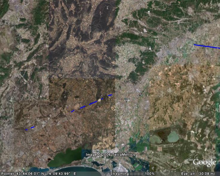
you can load the track in GoogleEarth
I have travelled the full length of the roman road where possible with my motorcycle in 2005. These visits comprise many roads and rural pathes where the roman road is still in use today as well as some offroad sections where the roman road was located with good maps and GPS. This placemark file is a collection of my GPS routes and tracks, which indicate those sections which I consider to be identified as parts of the 2000-years-old road. Even though I consulted plenty of literature I pass this information to you without warranty. Simply go there and see for yourself!
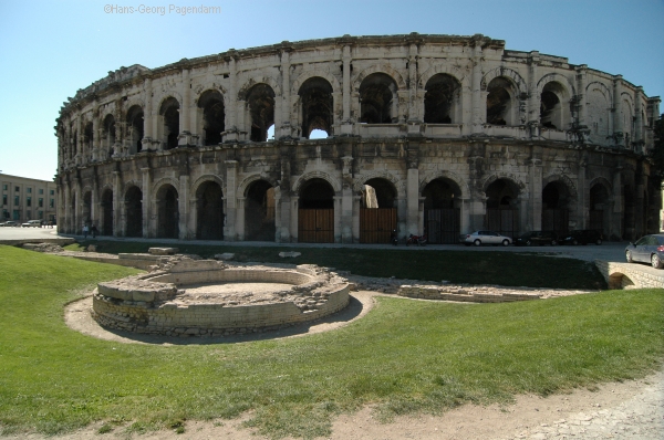 |
The Via Domitia in Nimes, FranceThe via domitia entered the city of Nimes (Nemausus)through a gate still visible today (Porte Auguste) an left the town west of the amphitheatre (Arenes) through a gate today named Porte de France. Further remarkable tourist attraction from the roman times: the Maison Carree (probably the most well conserved roman temple in this world), the Tour Magne, the Castellum Divisiorum (central distribution pond of the roman water supply system for the city)and a part of the roman town wall.kmz-files: |
 |
Section: Nimes AmbrussumThe Via Domitia left the city of Nimes (Nemausus) through a gate still visible today, the Porte de France. A milestone is displayed in a public garden in Bernis. It dates from the emperor Claudius about 41 A.C. Memory of the roman road is still lively with naming of streets today, such as "Voie Domitienne" at Uchaud and the "Rue de la Monaie" at Vergeze. South of Vergeze the roman road is idicated in the IGN-maps. |
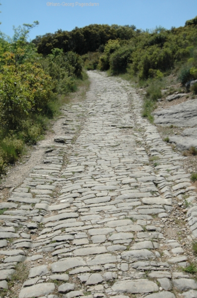 |
AmbrussumThe Via Domitia crossed the river Vidourle with a long stone bridge. One arch of this bridge still exists today. On the western banks of the river the remains of a roman villa have been excavated. During roman times and before there was a celtic town (oppidum ambrussum) on a nearby hill. The fortifications and many buildings are today hidden in the bushes of the garrigue. Follow the via domitia uphill to discover them and don´t forget to admire the pavement of the road which is well conserved here and shows the tracks of thousands of roman coaches carving the stone over centuries.All Google Earth placemarks of this section.
|
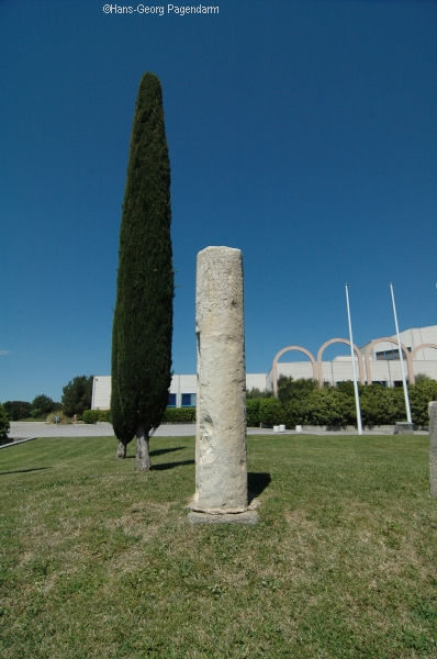 |
Section: Ambrussum SextantioWest of Ambrussum all traces of the Via Domitia soon disappear underneath today's freeway A9 which follows the old route, thus marking more than 2000 years of traffic on wheels. For the next 15 km to the west the roman road is crossed several times by the Autoroute to Montpellier. However, it is quite well possible to follow the old track on rural road. The path is marked on the maps and it is well recognizable because it forms a straight line. Further west the street name Rue de la Monnaie signals where the ancient route passed Vendargue. A milestone is displaced to the church of St.Aunes. In linear continuation one finds the Rue Domitienne in Le Cres. The church holds 2 milestones from the times of the emperors Tiberius and Augustus. In the garrigue between Le Cres and Castelnau le Lez the original surface of the Via Domitia may be visited in the bushes. Further into Castelnau there is an old milestone (see photo) at the side of the ancient road which is called Rue de la Monnaie here. The relais Sextantio was the oldest part of Castelnau quite close to the river Lez. The steep street which descends from there down to the banks of the river still today is called Voie DomitienneAll Google Earth placemarks of this section.
|
| more Google Earth related files | |
| Diese Seite auf deutsch |