 |
||
|
|
Section Beaucaire-Nimes of the Via Domitia

you can load the track in GoogleEarth
I have travelled the full length of the roman road where possible with my motorcycle in 2005. These visits comprise many roads and rural pathes where the roman road is still in use today as well as some offroad sections where the roman road was located with good maps and GPS. This placemark file is a collection of my GPS routes and tracks, which indicate those sections which I consider to be identified as parts of the 2000-years-old road. Even though I consulted plenty of literature I pass this information to you without warranty. Simply go there and see for yourself!
 |
Section Beaucaire-Nimes (Ugernum Nemausus)The roman road crossed the the river Rhone in Beaucaire (Ugernum) by ferry. In the west of the city there are three pieces of road named "Chemin des Romains". These perfectly match the line which markes the former trace of the via domitia. View "Chemin des Romains" in Beaucaire. View "Chemin des Romains" near Jonquieres St. Vincent. Further west the roman road is today's D999. There is a milestone at D999 and D135. More milestones are at mile 9,10,13,15 counted from Nimes towards Beaucaire. |
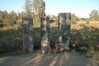 |
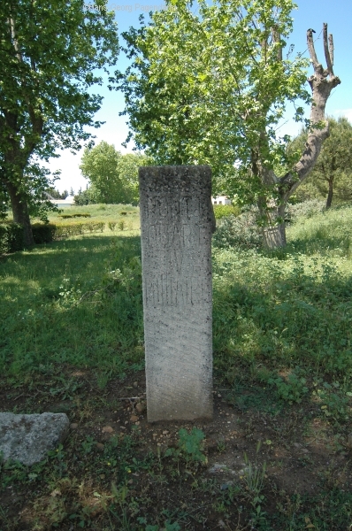
Milestone 13, Peyrous PlantadousBetween Nimes and Beaucaire the miles were counted from the Porta Augusta at Nimes. The 13th mile is a location with 4 milestones preserved at their original position. 3 of them are well preserved while one is only a small fraction left on the ground. Today the original inscriptions which were carved into the stones are barely visible. Today the Via Domitia here is preserved as a promenade near to a large quarry, only accessibly on foot. (gps N 43.81609°, O 4.59931°) |
 |
christianized milestoneAlmost exactly one roman mile along the Via Domitia west of the ensemble of milestones one finds this cross. Could this be a roman milestone converted at a later date? West of this position there is a steep slope not suitable for cars. |
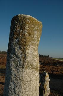 |
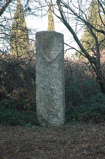
Milestone 10Further east at the tenth mile there are again several stones visible. One is standing upright and the mark X for the roman number ten is clearly visible. There are 3 more fragments. Usually, a milestone was erected whenever the road was refurbished. The stones honor the emperor in reign who ordered the repair works. The vary in style according to the time when they were erected. Therefor, often several stones existed for the same mile. However, many stones have been displaced and used elsewhere or disappeared. One such displaced milestone may be found in the chapel St.Laurent in Jonquieres north of here. |
 |
Milestone 9Milestone 9 is in a small forest along the Via Domitia which is a rural drive way. Further to the west the Via Domitia is covered by tarmac of the D999. |
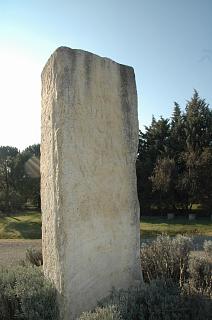 |
Milestone 7A milestone erected in the year 32 B.C. under the emperor Tiberius is preserved. A copy of it is diplayed at the crossroad leading to the village Manduel. There should be another milestone on display further towards the village but I was not able to locate it. |
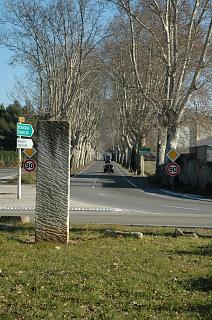 |
Milestone 4The location of mile 4 is marked by a modern display at the crossroad of the D999 and the D135. |
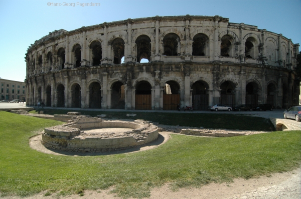 |
The Via Domitia in Nimes, FranceThe via domitia entered the city of Nimes (Nemausus)through a gate still visible today (Porte Auguste) an left the town west of the amphitheatre (Arenes) through a gate today named Porte de France. Further remarkable tourist attraction from the roman times: the Maison Carree (probably the most well conserved roman temple in this world), the Tour Magne, the Castellum Divisiorum (central distribution pond of the roman water supply system for the city)and a part of the roman town wall.kmz-files: |
| more Google Earth related files | |
| Diese Seite auf deutsch |